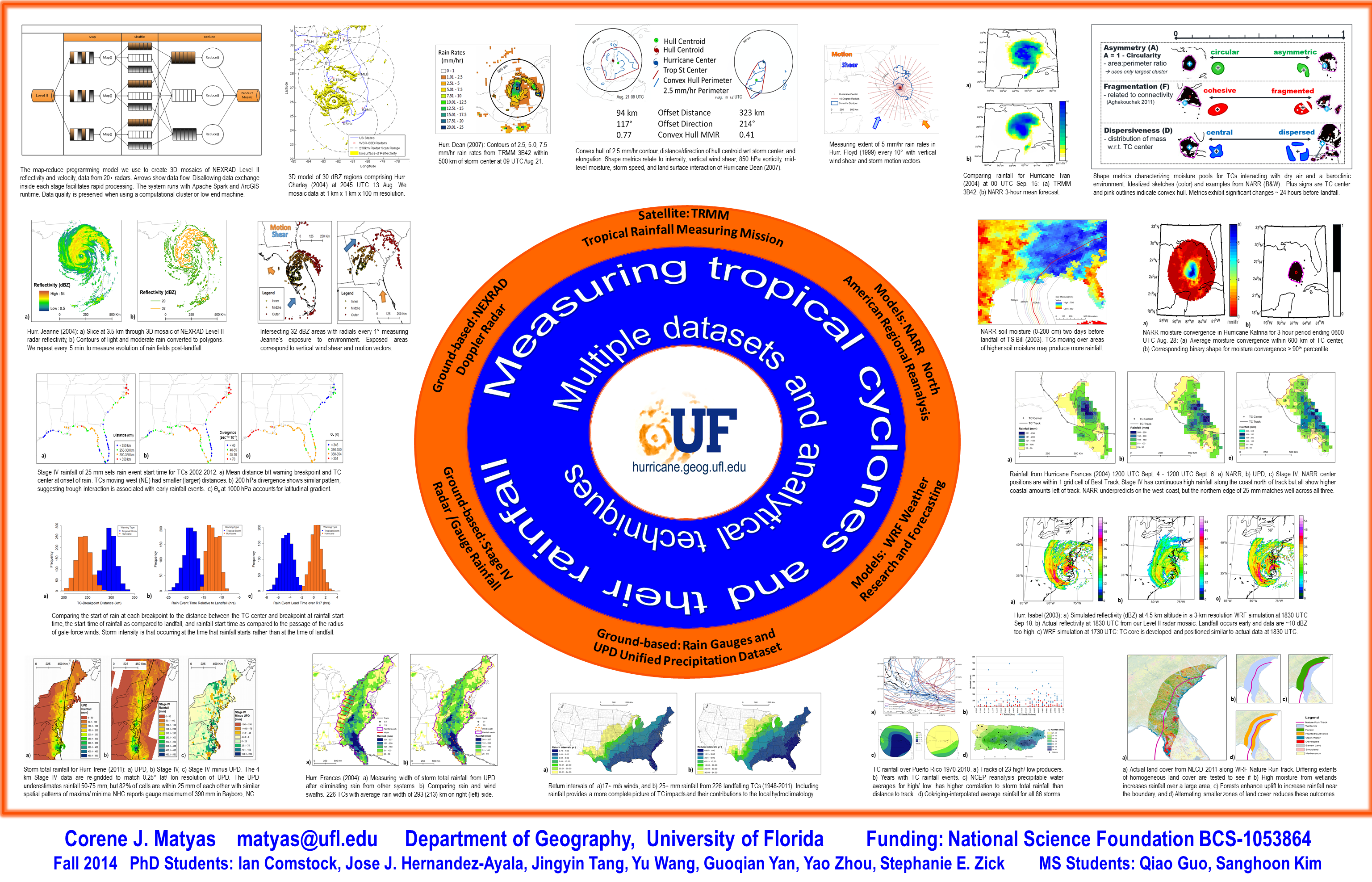
These are the projects that we are currently pursuing
| Last Name | First Name | Research Goal | Datasets | Temporal extent | Analysis Tools and Methods |
|---|---|---|---|---|---|
| Comstock | Ian | Defining tropical cyclone rain events along the U.S. coast and the timing of their onset | Stage IV Multisensor Precipitation, Extended Best Track, SHIPS, NHC Warnings and Advisories | 2002-Present | R, Regression, Resampling Methods |
| DesRosiers | Alex | NWS flood warnings and TC t racks | NWS warning polygons, TC tracks, rainfall datasets | 1998-2014 | GIS, nonparametric statistics |
| Kim | Sanghoon | Examine moisture patterns around TCs at landfall and compare to rain rates | NARR precipitable water, TRMM 3B42 | 1998-2012 | GIS |
| Matyas | Corene | Examine raining areas of tropical cyclones that landfall over Mexico | TRMM 3B42 | 1998-2014 | GIS, nonparametric statistics |
| Matyas | Corene | Measuring the degree of closure of tropical cyclone outer rainbands and inner core | Level II radar | 1997-2012 | GIS |
| Matyas, Zick, Tang | Corene, Stephanie, Jingyin | Use shape metrics to compare radar data for Hurricane Isabel (2003) observed vs. model simulations | WSR-88D, Tang's RadarComposite algorithms, WRF 3.6.1 | 2 WRF cumulus parameterizations and 3 microphysics parameterizations, shape metrics including closure, dispersiveness, fragmentation, solidity, convexity | |
| Tang | Jingyin | Construct three-dimensional structure of hurricane rainbands and decribe their evolvements | Level II | 1996-2005 | develop own scripts |
| Tang | Jingyin | ArcGIS tools handle common tasks for NEXRAD products. | Level II/III | https://bitbucket.org/striges/radar-tools.git | |
| Wang | Yu | Modify landcover types and rerun simulated TC landfall from Hurricane Nature Run 2 | WRF model, codes supplied by Dr. Nolan Univ. of Miami | WRF simulations for varying roughness lengths and moisture availability | |
| Yan | Guoqian | Rainfall patterns and environmental conditions for TCs in the Southwest Indian Ocean | TRMM, reanalysis data | 1998-2015 | |
| Zhou | Yao | Spatial variation of tropical cyclone precipitation over Eastern United States | Unified Precipitation Dataset | 1950-2011 | Python scripts to identify rainfall swath from daily rainfall data and measure areas and widths to either side of track |
| Zick | Stephanie | By examining water budgets in landfalling US tropical cyclones: 1) Determine the timing of interaction with landmass and/or mid-latitude regime, 2) Assess the evolution of the shape of TC moisture budget fields (including precipitation), and 3) Compare TCs landfalling in moist vs. dry continental air masses. | North American Regional Reanalysis (NARR), HURDAT2 | 1998-2012 | Matlab, R, Shape Statistics, Time Series Analysis, Nonparametric statistics, Synoptic weather type classification |